Our technology
Our unique technology enables us to certify & finance projects ten times faster than traditional certifiers.
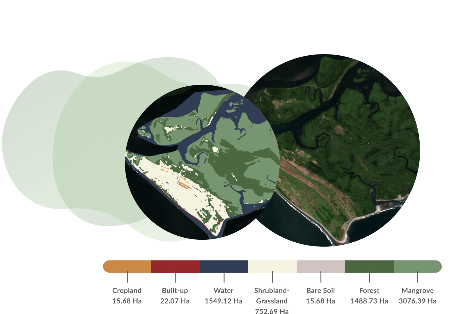
Rapid carbon estimation
We use satellite imagery and deep learning models to map the projects' location history, its current land cover and to precisely estimate the carbon baseline and expected additionality.
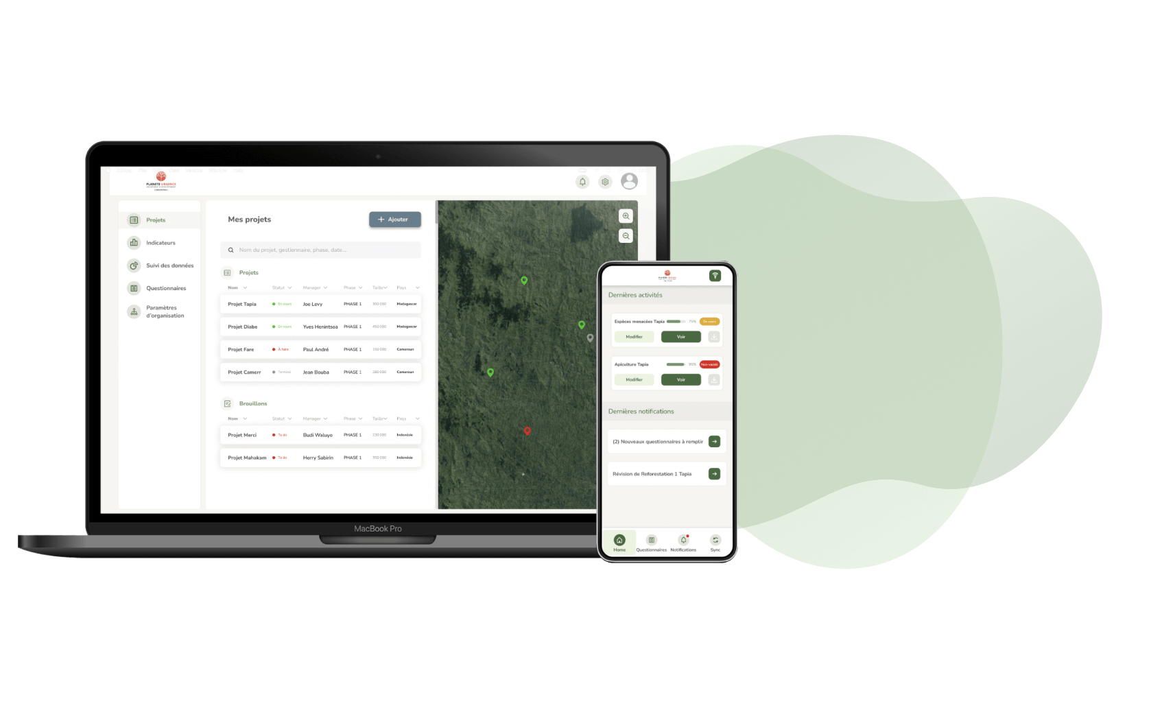
Constant monitoring
Our satellite technology allows us to monitor the evolution of forest cover and to detect any potential leakage or deforestation. A new high resolution image of the project is made available on our projects' platform every month.
Real-time field data
To complement our satellite data, we have developed a unique field app, allowing local teams to send us regular updates and precise field information throughout the projects' lifetime.


Copyright © 2022 Wildsense. All rights reserved